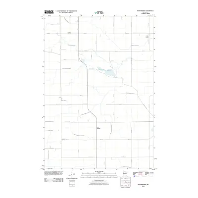
2010 Map of New Sweden
USGS Topo · Published 2010About this map
The agricultural landscape of Nicollet County is defined by an intricate network of waterways and managed drainage systems. The small settlement of New Sweden serves as a central point in this rural expanse, surrounded by the headwaters of the Middle Branch Rush River and South Branch Rush River. The geography is characterized by numerous engineered channels such as Judicial Ditch Number Fifteen and County Ditch Number Twentythree A, which illustrate the long-term efforts to manage the prairie wetlands for farming. For those researching local family history, several prominent burial grounds are preserved on this land, including the Goodman Cemetery, Trinity Lutheran Cemetery, and Greenwood Cemetery. Natural water bodies like Plaman Lake and Rice Lake break the grid-like pattern of township roads and county highways that segment the territory.
Find a feature on this map
41 named features on this map. Tap any name to fly to it.
Don’t see what you’re looking for? This feature index may not catch every label — zoom into the map to look around manually.
Map Details
Editions of this 2010 New Sweden Map
This is the sole edition of this map. No revisions or reprints were ever made.
Other maps of this area

1953 · New Ulm
USGS Topo · 1:250,000

1957 · New Ulm
USGS Topo · 1:250,000

1958 · New Ulm
USGS Topo · 1:250,000

1958 · Gaylord
USGS Topo · 1:62,500

1958 · Winthrop
USGS Topo · 1:62,500

1964 · Bernadotte
USGS Topo · 1:24,000

1964 · Courtland
USGS Topo · 1:24,000

1965 · Norseland
USGS Topo · 1:24,000

1965 · New Sweden
USGS Topo · 1:24,000

1965 · North Star
USGS Topo · 1:24,000