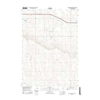
2015 Map of New Underwood SW
USGS Topo · Published 2015About this map
Box Elder anchors the northwestern corner of this Pennington County landscape, where the High Plains topography is defined by the winding course of Boxelder Cr. This 2015 survey illustrates a rural transition where traditional ranching terrain meets modern residential development, evidenced by the network of local roads such as Long View Rd and Justice Ln. The southeastern section of the map reveals the engineered water management of the region through the Lone Tree Ditch, a critical piece of infrastructure for local agriculture. Collectors and local historians can trace the naming conventions of newer rural subdivisions, with street names like Lonesome Dove St and Latigo Ave reflecting a western character. The map also includes the Caputa Loop in the southwest, showing the connectivity between these outlying prairie communities and the larger regional transport corridors.
Find a feature on this map
23 named features on this map. Tap any name to fly to it.
Don’t see what you’re looking for? This feature index may not catch every label — zoom into the map to look around manually.
Map Details
Editions of this 2015 New Underwood SW Map
This is the sole edition of this map. No revisions or reprints were ever made.
Other maps of this area

1893 · Rapid
USGS Topo · 1:125,000

1894 · Hermosa
USGS Topo · 1:125,000

1898 · Rapid
USGS Topo · 1:125,000

1901 · Hermosa
USGS Topo · 1:125,000

1903 · Rapid
USGS Topo · 1:125,000

1953 · Bend
USGS Topo · 1:24,000

1953 · Viewfield
USGS Topo · 1:24,000

1953 · Boxelder
USGS Topo · 1:24,000

1953 · New Underwood
USGS Topo · 1:24,000

1953 · New Underwood SW
USGS Topo · 1:24,000