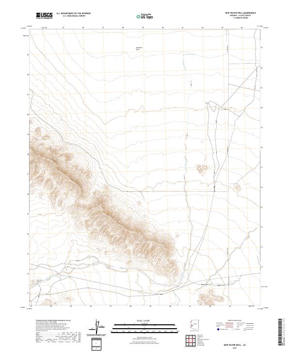
2021 Map of New Water Well
USGS Topo · Published 2021About this map
Ranegras Plain dominates the northern expanse of this La Paz County landscape, where the arid environment is defined by drainage patterns and critical water points. The namesake New Water Well is located in the southwestern corner, a vital site for desert travel and survival in this corner of Arizona. Crossing from north to south, Alamo Wash serves as the primary hydrological feature, collecting runoff from the high ridges that separate the plain from the southern basins. Transportation in the area is anchored by Vicksburg Rd, which runs along the eastern edge of the quadrangle. Other isolated water features like Crowder Tank punctuate the northern desert floor, illustrating the sparse but essential network of water management used for ranching and transit in this high-relief terrain.
Find a feature on this map
9 named features on this map. Tap any name to fly to it.
Don’t see what you’re looking for? This feature index may not catch every label — zoom into the map to look around manually.
Map Details
Editions of this 2021 New Water Well Map
This is the sole edition of this map. No revisions or reprints were ever made.
Other maps of this area

1942 · Vicksburg
USGS Topo · 1:250,000

1954 · Phoenix
USGS Topo · 1:250,000

1957 · Phoenix
USGS Topo · 1:250,000

1958 · Phoenix
USGS Topo · 1:250,000

1960 · Phoenix
USGS Topo · 1:250,000

1961 · Hope
USGS Topo · 1:62,500

1962 · Little Horn Mts
USGS Topo · 1:62,500

1962 · Kofa Butte
USGS Topo · 1:62,500

1962 · Vicksburg
USGS Topo · 1:62,500

1969 · Phoenix
USGS Topo · 1:250,000