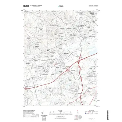
2019 Map of Newark East
USGS Topo · Published 2019About this map
White Clay Creek and the Christina River dominate this modern landscape in New Castle County, tracing a path through a dense network of suburban residential developments and historical crossroads. The map reveals the deep-seated settlement patterns of the Delmarva Peninsula, where established communities like Corner Ketch, Mermaid, and Milltown sit amidst a modern grid of named neighborhoods. Genealogical interest is particularly high here, with several significant burial grounds preserved within the urban fabric, including Ebenezer Cem, Saint James Cem, and the Salem-Methodist Cem. Industrial and transport history is represented by the B & O RR corridor, while the unusual naming of Bread and Cheese Island and features like Smalleys Pond provide specific landmarks for local historians and researchers tracking land use and water resources in this part of Delaware.
Find a feature on this map
446 named features on this map. Tap any name to fly to it.
Don’t see what you’re looking for? This feature index may not catch every label — zoom into the map to look around manually.
Map Details
Editions of this 2019 Newark East Map
This is the sole edition of this map. No revisions or reprints were ever made.
Other maps of this area

1898 · Elkton
USGS Topo · 1:62,500

1900 · Elkton
USGS Topo · 1:62,500

1901 · West Chester
USGS Topo · 1:62,500

1904 · West Chester
USGS Topo · 1:62,500

1904 · Coatesville
USGS Topo · 1:62,500

1904 · Wilmington
USGS Topo · 1:62,500

1906 · Coatesville
USGS Topo · 1:62,500

1906 · Wilmington
USGS Topo · 1:62,500

1917 · Elkton
USGS Topo · 1:62,500

1918 · Coatesville
USGS Topo · 1:62,500