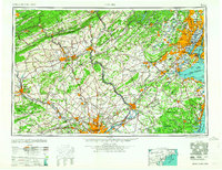
1964 Map of Newark
USGS Topo · Published 1964About this map
Industrial corridors and transportation networks define this mid-century survey of the Northeast, anchoring a region spanning from the Pocono Mountains to the Atlantic coast. The landscape is dominated by the massive urbanization around Newark, Philadelphia, and Trenton, where the concentration of infrastructure reflects the peak of rail and early interstate travel. Major rail lines like the Pennsylvania RR and Erie Lackawanna RR converge on the ports of Upper New York Bay and Raritan Bay, illustrating the area's role as a global logistics hub.
Find a feature on this map
126 named features on this map. Tap any name to fly to it.
Don’t see what you’re looking for? This feature index may not catch every label — zoom into the map to look around manually.
Map Details
Editions of this 1964 Newark Map
2 editions found

Other maps of this area

1884 · Whitings
USGS Topo · 1:62,500

1888 · Franklin
USGS Topo · 1:62,500

1888 · Plainfield
USGS Topo · 1:62,500

1888 · Bordentown
USGS Topo · 1:62,500

1888 · Pemberton
USGS Topo · 1:62,500

1888 · Barnegat
USGS Topo · 1:62,500

1888 · Morristown
USGS Topo · 1:62,500

1888 · Hackettstown
USGS Topo · 1:62,500

1888 · New Brunswick
USGS Topo · 1:62,500

1888 · Mount Holly
USGS Topo · 1:62,500