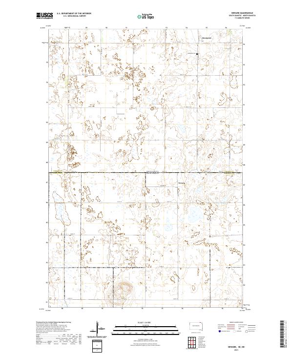
2021 Map of Newark
USGS Topo · Published 2021About this map
Newark sits at the intersection of Newark Rd and 421st Ave, a community straddling the border between South Dakota and North Dakota. This prairie landscape is defined by the rigid grid of section lines and range townships, where the border between Sargent Co and Marshall Co forms a central east-west axis. To the north, the settlement of Brampton is established near Co Rd 5, with the Brampton Cem serving as a local landmark for genealogists. The terrain is notably dotted with numerous depressions and wetlands typical of the Glacial Lake Agassiz region, influencing the path of local roads like 122nd Ave SE and 101st St SE. The map illustrates the persistent structure of agricultural land divisions and the sparse, purposeful placement of rural infrastructure in the eastern Dakotas.
Find a feature on this map
27 named features on this map. Tap any name to fly to it.
Don’t see what you’re looking for? This feature index may not catch every label — zoom into the map to look around manually.
Map Details
Editions of this 2021 Newark Map
This is the sole edition of this map. No revisions or reprints were ever made.
Other maps of this area

1953 · Britton East
USGS Topo · 1:24,000

1953 · Newark SW
USGS Topo · 1:24,000

1953 · Kidder
USGS Topo · 1:24,000

1953 · Newark
USGS Topo · 1:24,000

1953 · Milbank
USGS Topo · 1:250,000

1953 · Fargo
USGS Topo · 1:250,000

1956 · Fargo
USGS Topo · 1:250,000
1956 · Straubville
USGS Topo · 1:24,000

1956 · Britton West
USGS Topo · 1:24,000

1956 · Newark NW
USGS Topo · 1:24,000