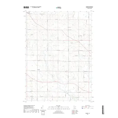
2018 Map of Newark
USGS Topo · Published 2018About this map
Orfordville sits at the northern edge of this Rock County landscape, which is defined by a dense network of country roads and several meandering waterways. The drainage of Raccoon Cr and its E Fork Raccoon Cr flows through the central and southern portions of the territory, while Bass Cr cuts across the northeastern corner. This area maintains its rural character through established family and community landmarks, including several burial grounds that serve as touchstones for local genealogy.
Find a feature on this map
49 named features on this map. Tap any name to fly to it.
Don’t see what you’re looking for? This feature index may not catch every label — zoom into the map to look around manually.
Map Details
Editions of this 2018 Newark Map
This is the sole edition of this map. No revisions or reprints were ever made.
Other maps of this area

1891 · Janesville
USGS Topo · 1:62,500

1893 · Janesville
USGS Topo · 1:62,500

1893 · Brodhead
USGS Topo · 1:62,500

1918 · Rockford
USGS Topo · 1:62,500

1932 · Pecatonica
USGS Topo · 1:62,500

1936 · Pecatonica
USGS Topo · 1:62,500

1938 · Rockford
USGS Topo · 1:62,500

1954 · Rockford
USGS Topo · 1:250,000

1955 · Rockford
USGS Topo · 1:250,000

1958 · Rockford
USGS Topo · 1:250,000