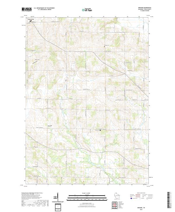
2022 Map of Newark
USGS Topo · Published 2022About this map
Orfordville sits in the northwest corner of this Rock County landscape, serving as a primary point of settlement amidst a grid of rural agricultural roads. The area is defined by the winding paths of Raccoon Cr and the E Fork Raccoon Cr, which cut through the southern half of the quadrangle, while Bass Cr drains the northeast. This 2022 survey reveals a legacy of local community history preserved through its burial grounds and religious sites, including the Orfordville Lutheran Cem, Maple Grove Cem, Plymouth Cem, and Newark Cem. These sites, often positioned at rural intersections or near parish roads like W Plymouth Church Rd, indicate the historical placement of rural congregations and family farmsteads. The land remains largely dedicated to open space and recreation, noted by landmarks such as Mumm Field, while a dense network of country lanes like W Beloit Newark Rd and W Cleophas Rd connects the scattered homesteads.
Find a feature on this map
39 named features on this map. Tap any name to fly to it.
Don’t see what you’re looking for? This feature index may not catch every label — zoom into the map to look around manually.
Map Details
Editions of this 2022 Newark Map
This is the sole edition of this map. No revisions or reprints were ever made.
Other maps of this area

1891 · Janesville
USGS Topo · 1:62,500

1893 · Janesville
USGS Topo · 1:62,500

1893 · Brodhead
USGS Topo · 1:62,500

1918 · Rockford
USGS Topo · 1:62,500

1932 · Pecatonica
USGS Topo · 1:62,500

1936 · Pecatonica
USGS Topo · 1:62,500

1938 · Rockford
USGS Topo · 1:62,500

1954 · Rockford
USGS Topo · 1:250,000

1955 · Rockford
USGS Topo · 1:250,000

1958 · Rockford
USGS Topo · 1:250,000