
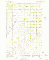
1953 Map of Newark SW
USGS Topo · Published 1955About this map
Great Northern rail lines and managed water systems define this mid-century landscape along the border of Brown and Marshall Counties. The region is marked by an extensive network of drainage infrastructure, including the prominent Crow Creek, an associated Ditch, and several Spoil Bank features, reflecting efforts to manage the wetlands typical of this Missouri River Basin territory. Notable hydraulic features such as Flowing Well appear throughout the townships of Portage, Dayton, and Stena. In the southwest, Renzienhausen Slough sits near the township of Detroit, while rural educational life is anchored by School No 3 in the eastern portion of the survey. The mapping project was part of a larger federal initiative for the development of the Missouri River Basin, utilizing plane-table surveys to document the topography and agricultural layout of this prairie environment.
Find a feature on this map
13 named features on this map. Tap any name to fly to it.
Don’t see what you’re looking for? This feature index may not catch every label — zoom into the map to look around manually.
Map Details
Editions of this 1953 Newark SW Map
This is the sole edition of this map. No revisions or reprints were ever made.
Other maps of this area

1894 · Hecla
USGS Topo · 1:62,500

1896 · Columbia
USGS Topo · 1:125,000

1953 · Hecla SE
USGS Topo · 1:24,000

1953 · Newark
USGS Topo · 1:24,000

1953 · Milbank
USGS Topo · 1:250,000

1954 · Aberdeen
USGS Topo · 1:250,000

1956 · Aberdeen
USGS Topo · 1:250,000

1956 · Britton West
USGS Topo · 1:24,000
1956 · Claremont
USGS Topo · 1:24,000

1956 · Newark NW
USGS Topo · 1:24,000
Featured Places
- Portage Township, SD
- South Detroit Township, SD
- Sunset Hutterite Colony, SD
- North Detroit Township, SD
- Brown County, SD