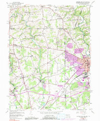
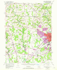
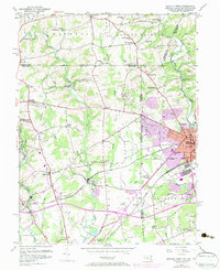
1953 Map of Newark West
USGS Topo · Published 1991About this map
The Mason and Dixon Line serves as a central axis for this mid-century survey, where the borders of Maryland, Pennsylvania, and Delaware converge. In the east, the growing campus of the University of Delaware anchors Newark, while the surrounding countryside remains a landscape of small agricultural settlements and rural institutions. The map documents the intricate network of watercourses that defined local industry and boundaries, including the Big Elk Creek and the headwaters of the Christina River.
Find a feature on this map
71 named features on this map. Tap any name to fly to it.
Don’t see what you’re looking for? This feature index may not catch every label — zoom into the map to look around manually.
Map Details
Editions of this 1953 Newark West Map
6 editions found
Other maps of this area

1898 · Elkton
USGS Topo · 1:62,500

1900 · Elkton
USGS Topo · 1:62,500

1901 · West Chester
USGS Topo · 1:62,500

1904 · West Chester
USGS Topo · 1:62,500

1904 · Coatesville
USGS Topo · 1:62,500

1904 · Wilmington
USGS Topo · 1:62,500

1906 · Coatesville
USGS Topo · 1:62,500

1906 · Wilmington
USGS Topo · 1:62,500

1917 · Elkton
USGS Topo · 1:62,500

1918 · Coatesville
USGS Topo · 1:62,500