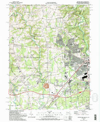
1992 Map of Newark West
USGS Topo · Published 1993About this map
The Mason and Dixon Line serves as a defining boundary in this region, marking the convergence of Maryland, Pennsylvania, and Delaware. The landscape is dominated by large-scale preservation and recreational areas, notably the Fair Hill State Natural Resources Management Area, which preserves a significant corridor along Big Elk Creek. This area, once a private estate, is characterized by its equestrian facilities, including the Fair Hill Race Track.
Find a feature on this map
77 named features on this map. Tap any name to fly to it.
Don’t see what you’re looking for? This feature index may not catch every label — zoom into the map to look around manually.
Map Details
Editions of this 1992 Newark West Map
3 editions found
Other maps of this area

1898 · Elkton
USGS Topo · 1:62,500

1900 · Elkton
USGS Topo · 1:62,500

1901 · West Chester
USGS Topo · 1:62,500

1904 · West Chester
USGS Topo · 1:62,500

1904 · Coatesville
USGS Topo · 1:62,500

1904 · Wilmington
USGS Topo · 1:62,500

1906 · Coatesville
USGS Topo · 1:62,500

1906 · Wilmington
USGS Topo · 1:62,500

1917 · Elkton
USGS Topo · 1:62,500

1918 · Coatesville
USGS Topo · 1:62,500