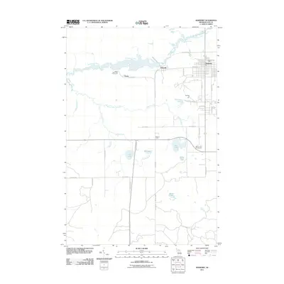
2011 Map of Newberry
USGS Topo · Published 2011About this map
The Tahquamenon River winds through the northern portion of this landscape, creating a complex wetland environment that includes Spider Bay and the settlement of Dollarville. This village, once a thriving lumber center, is situated along the river's path, while the larger village of Newberry serves as the regional hub to the east, anchored by the Newberry Post Office. The area is defined by its recreation and forestry, featuring the Big Valley Ski Area and the Natalie State Forest Campground near the community of Natalie.
Find a feature on this map
40 named features on this map. Tap any name to fly to it.
Don’t see what you’re looking for? This feature index may not catch every label — zoom into the map to look around manually.
Map Details
Editions of this 2011 Newberry Map
This is the sole edition of this map. No revisions or reprints were ever made.
Other maps of this area

1931 · Gould City NE
USGS Topo · 1:31,680

1931 · Gould City NW
USGS Topo · 1:31,680

1931 · Gilchrist NW
USGS Topo · 1:31,680

1954 · Sault Sainte Marie
USGS Topo · 1:250,000

1956 · Sault Sainte Marie
USGS Topo · 1:250,000

1957 · Sault Sainte Marie
USGS Topo · 1:250,000

1958 · Sault Sainte Marie
USGS Topo · 1:250,000

1962 · Auger Lake
USGS Topo · 1:24,000
1973 · Curtis East
USGS Topo · 1:24,000
1973 · McMillan
USGS Topo · 1:24,000