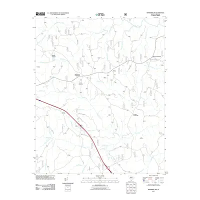
2011 Map of Newberry NW
USGS Topo · Published 2011About this map
Cromer Crossroads and Brickhouse Crossroads anchor this rural Newberry County landscape, where the road network follows the ridges between numerous drainage basins. The area is defined by its complex hydrology, with the South Fork Duncan Creek and Indian Creek carving through the terrain. Evidence of long-standing community centers appears in the distribution of burial grounds, such as Mount Tabor Cemetery and Zion Cemetery, which are often the most enduring markers of local family history in this part of South Carolina. The presence of Stomp Springs in the northwest and the Brick House Campground suggests a landscape that balances agricultural residency with outdoor recreation. This survey captures the transition of traditional rural intersections into the modern era, maintaining named locations like Eison Crossroads alongside state infrastructure like State Rd S-36-798.
Find a feature on this map
45 named features on this map. Tap any name to fly to it.
Don’t see what you’re looking for? This feature index may not catch every label — zoom into the map to look around manually.
Map Details
Editions of this 2011 Newberry NW Map
This is the sole edition of this map. No revisions or reprints were ever made.
Other maps of this area

1941 · Spartanburg
USGS Topo · 1:250,000

1953 · Spartanburg
USGS Topo · 1:250,000

1960 · Spartanburg
USGS Topo · 1:250,000

1963 · Spartanburg
USGS Topo · 1:250,000

1964 · Spartanburg
USGS Topo · 1:250,000

1968 · Newberry East
USGS Topo · 1:24,000

1969 · Whitmire South
USGS Topo · 1:24,000

1969 · Newberry NW
USGS Topo · 1:24,000

1969 · Sedalia
USGS Topo · 1:24,000
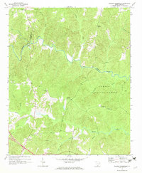
1969 · Philson Crossroads
USGS Topo · 1:24,000
Featured Places
- Cromer Crossroads, SC
- Eison Crossroads, SC
- Stomp Springs, SC
- Brickhouse Crossroads, SC
- Laurens County, SC