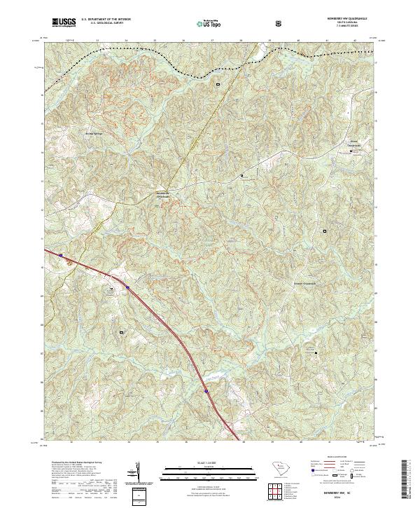
2024 Map of Newberry NW
USGS Topo · Published 2024About this map
Sumter National Forest dominates the interior of this Newberry County landscape, where modern recreation trails now weave through a historically agrarian corridor. The map highlights several intersection communities that served as local hubs, including Brickhouse Crossroads, Cromer Crossroads, and Eison Crossroads. These small settlements are anchored by longstanding religious and burial sites such as the Fairview Church Graveyard and Mount Zion AME Church Cem, which provide essential touchpoints for genealogical research in the region.
Find a feature on this map
64 named features on this map. Tap any name to fly to it.
Don’t see what you’re looking for? This feature index may not catch every label — zoom into the map to look around manually.
Map Details
Editions of this 2024 Newberry NW Map
This is the sole edition of this map. No revisions or reprints were ever made.
Other maps of this area

1941 · Spartanburg
USGS Topo · 1:250,000

1953 · Spartanburg
USGS Topo · 1:250,000

1960 · Spartanburg
USGS Topo · 1:250,000

1963 · Spartanburg
USGS Topo · 1:250,000

1964 · Spartanburg
USGS Topo · 1:250,000

1968 · Newberry East
USGS Topo · 1:24,000

1969 · Whitmire South
USGS Topo · 1:24,000

1969 · Newberry NW
USGS Topo · 1:24,000

1969 · Sedalia
USGS Topo · 1:24,000
1969 · Philson Crossroads
USGS Topo · 1:24,000
Featured Places
- Cromer Crossroads, SC
- Eison Crossroads, SC
- Stomp Springs, SC
- Brickhouse Crossroads, SC
- Laurens County, SC