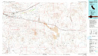
1977 Map of Newberry Springs
USGS Topo · Published 1993About this map
Mojave River drainage and the surrounding High Desert terrain define this 1970s landscape, where the intersection of transit and extraction is evident in every corner of San Bernardino County. The corridor following the Union Pacific and the Atchison Topeka and Santa Fe Railroad connects historic stops like Newberry Springs and Daggett with more remote outposts such as Ludlow. This region is a study in industrial persistence, featuring a high density of mining sites including the Barium Queen Mine and Silver Bell Mine scattered through the Calico Mountains and Newberry Mountains.
Find a feature on this map
69 named features on this map. Tap any name to fly to it.
Don’t see what you’re looking for? This feature index may not catch every label — zoom into the map to look around manually.
Map Details
Editions of this 1977 Newberry Springs Map
This is the sole edition of this map. No revisions or reprints were ever made.
Other maps of this area

1901 · Southern California Sheet No. 1
USGS Topo · 1:250,000

1902 · Deep Creek
USGS Topo · 1:62,500

1902 · San Gorgonio
USGS Topo · 1:125,000

1904 · Southern California Sheet No. 1
USGS Topo · 1:250,000

1910 · Ivanpah
USGS Topo · 1:250,000

1912 · Ivanpah
USGS Topo · 1:250,000

1915 · Searles Lake
USGS Topo · 1:250,000

1932 · Barstow
USGS Topo · 1:125,000

1933 · Avawatz Mountains
USGS Topo · 1:250,000

1934 · Barstow
USGS Topo · 1:125,000