
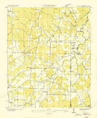
1936 Map of Newburg
USGS Topo · Published 1936About this map
Newburg and the rural uplands of Franklin County are the focus of this 1936 survey, conducted shortly before much of this area was integrated into the Black Warrior National Forest. The landscape is defined by the headwaters of the Tenn Basin Divide, where numerous small creeks like Mud Creek and Troublesome Creek carve through the terrain. Evidence of a deeply established rural community is present through a dense network of family-named landmarks and local institutions, including Sylvester Ch, Oak Grove Ch, and the County Line Sch.
Find a feature on this map
47 named features on this map. Tap any name to fly to it.
Don’t see what you’re looking for? This feature index may not catch every label — zoom into the map to look around manually.
Map Details
Editions of this 1936 Newburg Map
This is the sole edition of this map. No revisions or reprints were ever made.
Other maps of this area

1924 · Tuscumbia
USGS Topo · 1:48,000

1926 · Tuscumbia
USGS Topo · 1:62,500

1936 · Russellville
USGS Topo · 1:24,000

1936 · Kinlock Spring
USGS Topo · 1:24,000

1936 · Phil Campbell
USGS Topo · 1:24,000

1936 · Moulton
USGS Topo · 1:48,000

1936 · Spruce Pine
USGS Topo · 1:24,000

1936 · Hatton
USGS Topo · 1:24,000

1936 · Landersville
USGS Topo · 1:24,000
1936 · Old Bethel
USGS Topo · 1:24,000