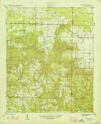
1947 Map of Newburg
USGS Topo · Published 1947About this map
Kimbrough Chapel and the nearby Kimbrough Cem serve as a focal point for this 1940s landscape in Franklin County, Alabama. The settlement of Newburg sits along the primary east-west corridor formed by the Russellville Road, which cuts across a terrain defined by deep hollows and prominent rises such as Macedonia Mtn and Eckerberger Mtn. The map reveals a community organized around rural institutions, including Piney Grove Sch and churches like Sylvester Ch and New Hope Ch.
Find a feature on this map
46 named features on this map. Tap any name to fly to it.
Don’t see what you’re looking for? This feature index may not catch every label — zoom into the map to look around manually.
Map Details
Editions of this 1947 Newburg Map
2 editions found
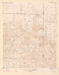
Other maps of this area

1924 · Tuscumbia
USGS Topo · 1:48,000

1926 · Tuscumbia
USGS Topo · 1:62,500

1936 · Russellville
USGS Topo · 1:24,000

1936 · Newburg
USGS Topo · 1:24,000

1936 · Kinlock Spring
USGS Topo · 1:24,000

1936 · Phil Campbell
USGS Topo · 1:24,000

1936 · Moulton
USGS Topo · 1:48,000

1936 · Spruce Pine
USGS Topo · 1:24,000

1936 · Hatton
USGS Topo · 1:24,000

1936 · Landersville
USGS Topo · 1:24,000