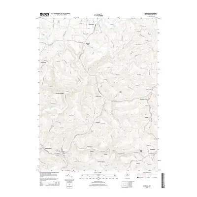
2014 Map of Newburg
USGS Topo · Published 2014About this map
Arthurdale and the surrounding Preston County landscape are defined by a network of small settlements and mountain ridges. The terrain transitions from the heights of Mt Phoebe and Chestnut Ridge down into the valleys of Three Fork Creek and Raccoon Cr. This 2014 edition highlights the region's infrastructure, from the Kingwood Tunnel near Tunnelton to the Richard Taylor Bridge in Newburg. Local history is anchored by numerous family and community sites, including Browns Mill, Concord, and a series of burial grounds like Arthurdale Cem and Pratt Cem. The map also documents local aviation via Titus Field Airport and Lynn Airport. The placement of Threefork Bridge and Hiorra along the drainage of Three Fork Creek illustrates how the area's geography historically dictated the paths of transportation and community development in this part of West Virginia.
Find a feature on this map
113 named features on this map. Tap any name to fly to it.
Don’t see what you’re looking for? This feature index may not catch every label — zoom into the map to look around manually.
Map Details
Editions of this 2014 Newburg Map
This is the sole edition of this map. No revisions or reprints were ever made.
Other maps of this area

1886 · St. George
USGS Topo · 1:125,000

1891 · St. George
USGS Topo · 1:125,000

1902 · Morgantown
USGS Topo · 1:62,500

1904 · Bruceton
USGS Topo · 1:62,500

1907 · Thornton
USGS Topo · 1:62,500

1907 · Kingwood
USGS Topo · 1:62,500

1925 · Kingwood
USGS Topo · 1:62,500

1925 · Morgantown
USGS Topo · 1:62,500

1926 · Thornton
USGS Topo · 1:62,500

1926 · Bruceton
USGS Topo · 1:62,500