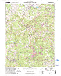
1997 Map of Newburg
USGS Topo · Published 2001About this map
Arthurdale remains a central focal point in this Preston County landscape, showcasing the distinct layout of the historic planned community established during the New Deal. The map traces the dense concentration of infrastructure surrounding the town, including the Arthurdale Sch and Arthurdale Cem, transitioning into the industrial character of the surrounding hills. Surface mining activity is prevalent across the terrain, with numerous Strip Mines and Strip Mine operations lining the ridges above Birds Creek and Squires Creek.
Find a feature on this map
57 named features on this map. Tap any name to fly to it.
Don’t see what you’re looking for? This feature index may not catch every label — zoom into the map to look around manually.
Map Details
Editions of this 1997 Newburg Map
This is the sole edition of this map. No revisions or reprints were ever made.
Other maps of this area

1886 · St. George
USGS Topo · 1:125,000

1891 · St. George
USGS Topo · 1:125,000

1902 · Morgantown
USGS Topo · 1:62,500

1904 · Bruceton
USGS Topo · 1:62,500

1907 · Thornton
USGS Topo · 1:62,500

1907 · Kingwood
USGS Topo · 1:62,500

1925 · Kingwood
USGS Topo · 1:62,500

1925 · Morgantown
USGS Topo · 1:62,500

1926 · Thornton
USGS Topo · 1:62,500

1926 · Bruceton
USGS Topo · 1:62,500