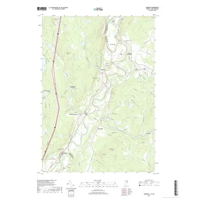
2018 Map of Newbury
USGS Topo · Published 2018About this map
The Connecticut River defines the winding border between Vermont and New Hampshire in this detailed topographic study, carving a wide fertile valley through the region. The landscape is marked by the distinctive loop of The Oxbow and the neighboring Ox-Bow Meadows, illustrating the river's historical movement. Near the river crossing at South Newbury, the Bedell Covered Bridge stands as a significant local landmark.
Find a feature on this map
99 named features on this map. Tap any name to fly to it.
Don’t see what you’re looking for? This feature index may not catch every label — zoom into the map to look around manually.
Map Details
Editions of this 2018 Newbury Map
This is the sole edition of this map. No revisions or reprints were ever made.
Other maps of this area

1928 · Rumney
USGS Topo · 1:62,500

1929 · Moosilauke
USGS Topo · 1:62,500

1931 · Mt. Cube
USGS Topo · 1:62,500

1931 · Woodsville
USGS Topo · 1:48,000

1932 · Rumney
USGS Topo · 1:62,500

1932 · Moosilauke
USGS Topo · 1:62,500

1933 · Mt. Cube
USGS Topo · 1:62,500

1935 · Woodsville
USGS Topo · 1:62,500

1941 · Woodsville
USGS Topo · 1:62,500

1949 · Portland
USGS Topo · 1:250,000