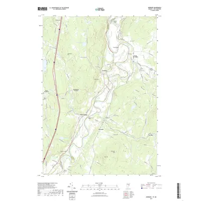
2021 Map of Newbury
USGS Topo · Published 2021About this map
The Connecticut River winds through this valley along the border of Vermont and New Hampshire, defining the fertile lowlands of Horse Meadow and the distinct loop known as The Oxbow. This river-oriented landscape supports a series of historic riverside settlements, including Newbury, South Newbury, and Haverhill. The terrain rises sharply away from the water to peaks like Pulaski Mtn and Town Farm Hill, while several small water bodies such as Halls Lake and The Fish Pond dot the higher elevations. Genealogists will find a high density of burial sites across both sides of the river, from the Ladd Street Cem to the West Newbury Cem. The presence of the Bedell-Covered Bridge and the cluster at Peach Four Corners highlights the enduring rural infrastructure that connects these farming communities across the state line.
Find a feature on this map
99 named features on this map. Tap any name to fly to it.
Don’t see what you’re looking for? This feature index may not catch every label — zoom into the map to look around manually.
Map Details
Editions of this 2021 Newbury Map
This is the sole edition of this map. No revisions or reprints were ever made.
Other maps of this area

1928 · Rumney
USGS Topo · 1:62,500

1929 · Moosilauke
USGS Topo · 1:62,500

1931 · Mt. Cube
USGS Topo · 1:62,500

1931 · Woodsville
USGS Topo · 1:48,000

1932 · Rumney
USGS Topo · 1:62,500

1932 · Moosilauke
USGS Topo · 1:62,500

1933 · Mt. Cube
USGS Topo · 1:62,500

1935 · Woodsville
USGS Topo · 1:62,500

1941 · Woodsville
USGS Topo · 1:62,500

1949 · Portland
USGS Topo · 1:250,000