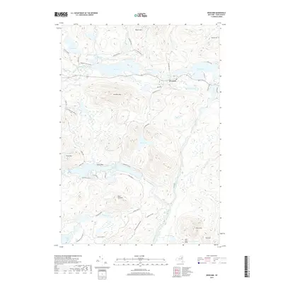
2019 Map of Newcomb
USGS Topo · Published 2019About this map
The settlement of Newcomb sits at a geographic crossroads in the heart of the Adirondack Park Preserve, surrounded by a complex system of interconnected waterways. The high peaks of Goodnow Mtn and Baldwin Mtn overlook a valley floor dominated by the Hudson River and its upper tributaries. This 2019 survey illustrates the intricate drainage patterns of the Goodnow River and Fishing Brook as they feed into significant water bodies like Harris Lake, Rich Lake, and Belden Lake. The map reveals a land management pattern defined by protected forest land, where narrow access ways such as Gooley Club Rd and Goodnow Flow Rd reach into the interior. To the south, the Essex Chain Lakes and the Blackwell Stillwater segment of the Hudson emphasize the region's character as a primitive wilderness and a vital watershed for New York State.
Find a feature on this map
55 named features on this map. Tap any name to fly to it.
Don’t see what you’re looking for? This feature index may not catch every label — zoom into the map to look around manually.
Map Details
Editions of this 2019 Newcomb Map
This is the sole edition of this map. No revisions or reprints were ever made.
Other maps of this area

1898 · Newcomb
USGS Topo · 1:62,500

1901 · Newcomb
USGS Topo · 1:62,500

1903 · Blue Mountain
USGS Topo · 1:62,500

1904 · Santanoni
USGS Topo · 1:62,500

1904 · Long Lake
USGS Topo · 1:62,500

1948 · Ogdensburg
USGS Topo · 1:250,000

1950 · Utica
USGS Topo · 1:250,000

1951 · Ogdensburg
USGS Topo · 1:250,000

1953 · Ogdensburg
USGS Topo · 1:250,000

1953 · Santanoni
USGS Topo · 1:62,500