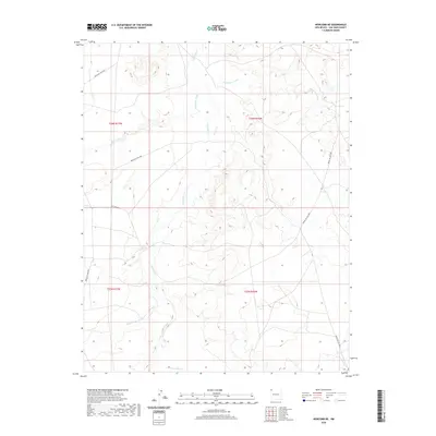
2020 Map of Newcomb NE
USGS Topo · Published 2020About this map
The Chaco River meanders northward through this arid landscape, serving as the central drainage for a series of ephemeral watercourses. This territory within the Shiprock Agency is defined by its drainage network, including the Sanostee Wash and Pinabete Arroyo, which carve distinct paths through the high desert. The area is intersected by several Bureau of Indian Affairs routes, such as Indian Svc Rte 5018 and Indian Svc Rte 5092, which facilitate travel through the vast, open sections of T26N R17W and T25N R16W. To the south, the Peña Blanca Arroyo joins the topographical narrative, illustrating the complex hydrologic patterns that dictate life and movement in this part of San Juan County.
Find a feature on this map
13 named features on this map. Tap any name to fly to it.
Don’t see what you’re looking for? This feature index may not catch every label — zoom into the map to look around manually.
Map Details
Editions of this 2020 Newcomb NE Map
This is the sole edition of this map. No revisions or reprints were ever made.
Other maps of this area

1889 · Chaco
USGS Topo · 1:250,000

1892 · Chaco
USGS Topo · 1:250,000

1927 · Sulphur Spring
USGS Topo · 1:96,000

1928 · Kirtland
USGS Topo · 1:125,000

1932 · Kirtland
USGS Topo · 1:125,000

1954 · Shiprock
USGS Topo · 1:250,000

1958 · Shiprock
USGS Topo · 1:250,000

1959 · Shiprock
USGS Topo · 1:250,000
1966 · Newcomb NE
USGS Topo · 1:24,000
1966 · Burnham Trading Post
USGS Topo · 1:24,000