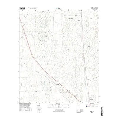
2017 Map of Newell
USGS Topo · Published 2017About this map
The eastern fringes of the Little Okefenokee Swamp dominate this landscape, where numerous sandy hammocks and islands rise slightly above the wetlands. Settlements such as Cypress Siding, Mattox, and Uptonville follow the corridor of the Old Dixie Hwy, tracing the higher ground of the Trail Ridge landform. This geological feature historically influenced movement through the region, providing a stable path between the swamp and the coastal plain.
Find a feature on this map
65 named features on this map. Tap any name to fly to it.
Don’t see what you’re looking for? This feature index may not catch every label — zoom into the map to look around manually.
Map Details
Editions of this 2017 Newell Map
This is the sole edition of this map. No revisions or reprints were ever made.
Other maps of this area

1917 · Nahunta
USGS Topo · 1:62,500

1917 · Boulogne
USGS Topo · 1:62,500

1918 · Folkston
USGS Topo · 1:62,500

1918 · Nahunta
USGS Topo · 1:62,500

1919 · Boulogne
USGS Topo · 1:62,500

1946 · Brunswick
USGS Topo · 1:250,000

1948 · Jacksonville
USGS Topo · 1:250,000

1948 · Brunswick
USGS Topo · 1:250,000

1953 · Waycross
USGS Topo · 1:250,000

1954 · Valdosta
USGS Topo · 1:250,000