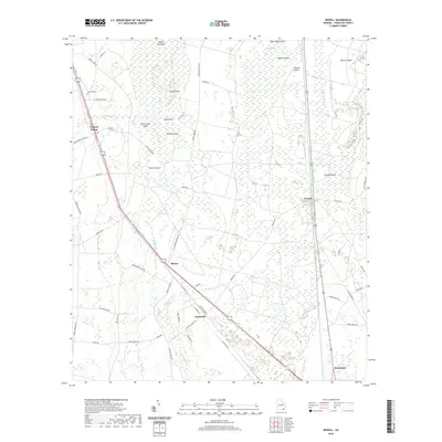
2020 Map of Newell
USGS Topo · Published 2020About this map
The Little Okefenokee Swamp dominates this landscape of southeastern Georgia, where dry islands rise above the hydrologic network. Settlements such as Uptonville and Mattox are positioned along the transit corridors that skirt the marshy terrain, including the Old Dixie Hwy. The proximity to the swamp is reflected in local place names like Trouble Valley and the numerous hammocks and islands, including Wilson Hammock, Sweet Gum Island, and Macks Island.
Find a feature on this map
57 named features on this map. Tap any name to fly to it.
Don’t see what you’re looking for? This feature index may not catch every label — zoom into the map to look around manually.
Map Details
Editions of this 2020 Newell Map
This is the sole edition of this map. No revisions or reprints were ever made.
Other maps of this area

1917 · Nahunta
USGS Topo · 1:62,500

1917 · Boulogne
USGS Topo · 1:62,500

1918 · Folkston
USGS Topo · 1:62,500

1918 · Nahunta
USGS Topo · 1:62,500

1919 · Boulogne
USGS Topo · 1:62,500

1946 · Brunswick
USGS Topo · 1:250,000

1948 · Jacksonville
USGS Topo · 1:250,000

1948 · Brunswick
USGS Topo · 1:250,000

1953 · Waycross
USGS Topo · 1:250,000

1954 · Valdosta
USGS Topo · 1:250,000