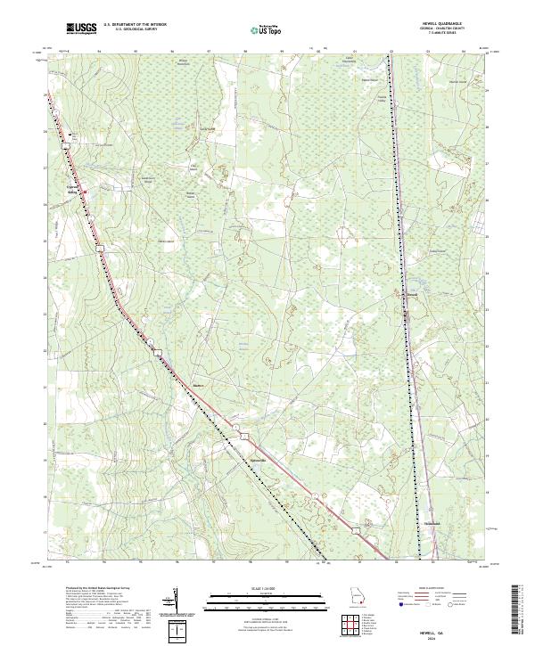
2024 Map of Newell
USGS Topo · Published 2024About this map
Okefenokee National Wildlife Refuge defines the western reaches of this landscape, where the eastern boundary of the Little Okefenokee Swamp meets the higher ground of Trail Ridge. The terrain is characterized by numerous islands and hammocks, such as Wilson Hammock, Sandy Island, and Sweet-Gum Island, interspersed with slow-moving water bodies like Spanish Creek and Little Buffalo Creek.
Find a feature on this map
62 named features on this map. Tap any name to fly to it.
Don’t see what you’re looking for? This feature index may not catch every label — zoom into the map to look around manually.
Map Details
Editions of this 2024 Newell Map
This is the sole edition of this map. No revisions or reprints were ever made.
Other maps of this area

1917 · Nahunta
USGS Topo · 1:62,500

1917 · Boulogne
USGS Topo · 1:62,500

1918 · Folkston
USGS Topo · 1:62,500

1918 · Nahunta
USGS Topo · 1:62,500

1919 · Boulogne
USGS Topo · 1:62,500

1946 · Brunswick
USGS Topo · 1:250,000

1948 · Jacksonville
USGS Topo · 1:250,000

1948 · Brunswick
USGS Topo · 1:250,000

1953 · Waycross
USGS Topo · 1:250,000

1954 · Valdosta
USGS Topo · 1:250,000