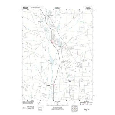
2011 Map of Newfield
USGS Topo · Published 2011About this map
The Maurice River and its numerous tributaries, including Scotland Run and Still Run, define the hydrology of this southern New Jersey landscape. The map highlights a series of small, interconnected settlements and early agricultural communities such as Brotmanville, Alliance, and Six Points. These locations, particularly Alliance, are significant for their history as Jewish agricultural colonies established in the late 19th century, with the Alliance Cemetery serving as a primary genealogical landmark for the region.
Find a feature on this map
183 named features on this map. Tap any name to fly to it.
Don’t see what you’re looking for? This feature index may not catch every label — zoom into the map to look around manually.
Map Details
Editions of this 2011 Newfield Map
This is the sole edition of this map. No revisions or reprints were ever made.
Other maps of this area

1890 · Hammonton
USGS Topo · 1:62,500

1890 · Tuckahoe
USGS Topo · 1:62,500

1890 · Bridgeton
USGS Topo · 1:62,500

1890 · Glassboro
USGS Topo · 1:62,500

1893 · Tuckahoe
USGS Topo · 1:62,500

1894 · Hammonton
USGS Topo · 1:62,500

1894 · Bridgeton
USGS Topo · 1:62,500

1898 · Glassboro
USGS Topo · 1:62,500

1898 · Hammonton
USGS Topo · 1:62,500

1899 · Vineland
USGS Topo · 1:125,000
Featured Places
- Vineland, NJ
- Newfield, NJ
- Brotmanville, Pittsgrove Township
- Upper Pittsgrove Township, NJ
- Pleasantville, Vineland