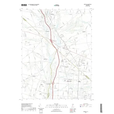
2019 Map of Newfield
USGS Topo · Published 2019About this map
Vineland serves as the major urban hub at the southern edge of this modern survey, where the convergence of Delsea Dr and several regional routes defines the local geography. The landscape is a complex patchwork of residential clusters and agricultural land, with the northern reaches of Vineland transitioning into smaller communities like North Vineland and Forest Grove. To the west, the historic Jewish agricultural colony of Alliance and its neighbor Brotmanville remain visible, anchored by the Alliance Cem and Alliance Airport. Hydrology is central to the area's layout, as Still Run, Scotland Run, and Little Ease Run feed into significant bodies of water including Malaga Lake and Willow Grove Lake. These waterways, along with features like Burnt Mill Br, illustrate the drainage patterns of the South Jersey pine barrens transition zone.
Find a feature on this map
173 named features on this map. Tap any name to fly to it.
Don’t see what you’re looking for? This feature index may not catch every label — zoom into the map to look around manually.
Map Details
Editions of this 2019 Newfield Map
This is the sole edition of this map. No revisions or reprints were ever made.
Other maps of this area

1890 · Hammonton
USGS Topo · 1:62,500

1890 · Tuckahoe
USGS Topo · 1:62,500

1890 · Bridgeton
USGS Topo · 1:62,500

1890 · Glassboro
USGS Topo · 1:62,500

1893 · Tuckahoe
USGS Topo · 1:62,500

1894 · Hammonton
USGS Topo · 1:62,500

1894 · Bridgeton
USGS Topo · 1:62,500

1898 · Glassboro
USGS Topo · 1:62,500

1898 · Hammonton
USGS Topo · 1:62,500

1899 · Vineland
USGS Topo · 1:125,000
Featured Places
- Vineland, NJ
- Newfield, NJ
- Brotmanville, Pittsgrove Township
- Upper Pittsgrove Township, NJ
- Pleasantville, Vineland