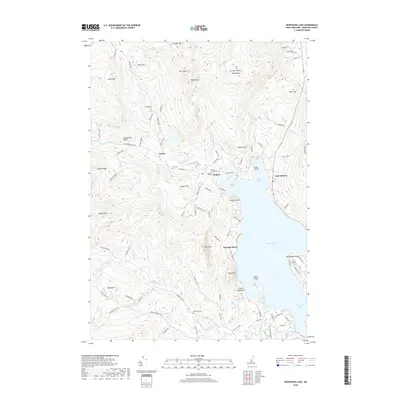
2018 Map of Newfound Lake
USGS Topo · Published 2018About this map
Newfound Lake dominates this New Hampshire landscape, with its northern waters reaching into Hebron Bay and Sanborn Bay. The settlement of Hebron sits at the northern tip of the lake, where the Cockermouth River enters the basin. To the west, the village of Groton is surrounded by the high elevations of Mt Crosby and Fletcher Mtn. For local history and genealogy, the map identifies several burial sites including Hebron Village Cem, Pratt Cem, and Riverside Cem. The terrain is characterized by numerous peaks such as Tenney Mtn and Bear Mtn, while unique features like Sculptured Rocks and Welton Falls mark the drainages of the Cockermouth River and Clark Brook. This modern survey details the road networks and water systems that define these small Grafton County communities.
Find a feature on this map
110 named features on this map. Tap any name to fly to it.
Don’t see what you’re looking for? This feature index may not catch every label — zoom into the map to look around manually.
Map Details
Editions of this 2018 Newfound Lake Map
This is the sole edition of this map. No revisions or reprints were ever made.
Other maps of this area

1925 · Holderness
USGS Topo · 1:62,500

1927 · Holderness
USGS Topo · 1:62,500

1927 · Cardigan
USGS Topo · 1:62,500

1928 · Plymouth
USGS Topo · 1:62,500

1928 · Rumney
USGS Topo · 1:62,500

1930 · Cardigan
USGS Topo · 1:62,500

1931 · Plymouth
USGS Topo · 1:62,500

1932 · Rumney
USGS Topo · 1:62,500

1949 · Portland
USGS Topo · 1:250,000

1956 · Cardigan
USGS Topo · 1:62,500