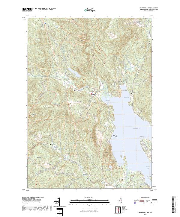
2024 Map of Newfound Lake
USGS Topo · Published 2024About this map
Newfound Lake and its northern shoreline define the character of this Grafton County landscape, where the Cockermouth River feeds into the broad waters of Hebron Bay. The topography is dominated by the granite-crested heights of Mt Crosby and Tenney Mtn, providing a dramatic backdrop for the historic settlements of Hebron and East Hebron. The area is characterized by a mix of summer recreational sites, such as Nuttings Beach, and deep-rooted community landmarks including the Hebron PO and Hebron Village Cem.
Find a feature on this map
126 named features on this map. Tap any name to fly to it.
Don’t see what you’re looking for? This feature index may not catch every label — zoom into the map to look around manually.
Map Details
Editions of this 2024 Newfound Lake Map
This is the sole edition of this map. No revisions or reprints were ever made.
Other maps of this area

1925 · Holderness
USGS Topo · 1:62,500

1927 · Holderness
USGS Topo · 1:62,500

1927 · Cardigan
USGS Topo · 1:62,500

1928 · Plymouth
USGS Topo · 1:62,500

1928 · Rumney
USGS Topo · 1:62,500

1930 · Cardigan
USGS Topo · 1:62,500

1931 · Plymouth
USGS Topo · 1:62,500

1932 · Rumney
USGS Topo · 1:62,500

1949 · Portland
USGS Topo · 1:250,000

1956 · Cardigan
USGS Topo · 1:62,500