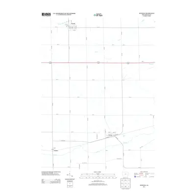
2013 Map of Newhall
USGS Topo · Published 2013About this map
Newhall and Norway serve as the primary hubs in this agricultural landscape of Benton County, defined by a rigid grid of section roads and the meandering paths of local waterways. The southern portion of the quadrangle is anchored by the community of Watkins, situated near the banks of Prairie Cr. This area illustrates the typical Midwestern township layout, where small rural centers developed alongside the rail corridors, evidenced by E Railroad St and W Railroad St in Norway. The drainage patterns of Little Bear Cr, Dry Cr, and Morgan Cr provide the only breaks in the geometric precision of the fields and farmsteads. The map also captures the settlement of Robin on the eastern edge, highlighting the enduring spatial relationship between small-town Iowa and the surrounding productive prairies during the early 21st century.
Find a feature on this map
47 named features on this map. Tap any name to fly to it.
Don’t see what you’re looking for? This feature index may not catch every label — zoom into the map to look around manually.
Map Details
Editions of this 2013 Newhall Map
This is the sole edition of this map. No revisions or reprints were ever made.
Other maps of this area

1888 · Shellsburg
USGS Topo · 1:62,500

1888 · Amana
USGS Topo · 1:62,500

1889 · Amana
USGS Topo · 1:62,500

1889 · Shellsburg
USGS Topo · 1:62,500

1899 · Amana
USGS Topo · 1:62,500

1899 · Shellsburg
USGS Topo · 1:62,500

1903 · Fairfax
USGS Topo · 1:125,000

1903 · Winthrop
USGS Topo · 1:125,000

1954 · Waterloo
USGS Topo · 1:250,000

1954 · Des Moines
USGS Topo · 1:250,000