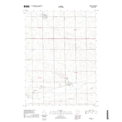
2018 Map of Newhall
USGS Topo · Published 2018About this map
Newhall and Norway anchor this portion of Benton County, reflecting the deep-rooted agricultural and railroad-oriented settlement of east-central Iowa. The landscape is structured by a rigorous grid of section lines and rural roads like Co Trunk Rd E44, yet the underlying topography is defined by the winding course of Prairie Creek and its various tributaries. This 2018 survey reveals a high density of small family and community burial grounds, including Raetz Cem and Mound Cem, which offer significant value for genealogical research. The rail alignment through Norway and the nearby village of Watkins underscores the historical importance of transit corridors in moving goods across the Iowa prairie. The transition from the more developed streets of Newhall, such as Railroad St and 1st St E, to the open drainage basins of Dry Cr and Morgan Cr illustrates the persistent balance between human engineering and the region's natural hydrology.
Find a feature on this map
38 named features on this map. Tap any name to fly to it.
Don’t see what you’re looking for? This feature index may not catch every label — zoom into the map to look around manually.
Map Details
Editions of this 2018 Newhall Map
This is the sole edition of this map. No revisions or reprints were ever made.
Other maps of this area

1888 · Shellsburg
USGS Topo · 1:62,500

1888 · Amana
USGS Topo · 1:62,500

1889 · Amana
USGS Topo · 1:62,500

1889 · Shellsburg
USGS Topo · 1:62,500

1899 · Amana
USGS Topo · 1:62,500

1899 · Shellsburg
USGS Topo · 1:62,500

1903 · Fairfax
USGS Topo · 1:125,000

1903 · Winthrop
USGS Topo · 1:125,000

1954 · Waterloo
USGS Topo · 1:250,000

1954 · Des Moines
USGS Topo · 1:250,000