2022 Map of Newhall
USGS Topo · Published 2022About this map
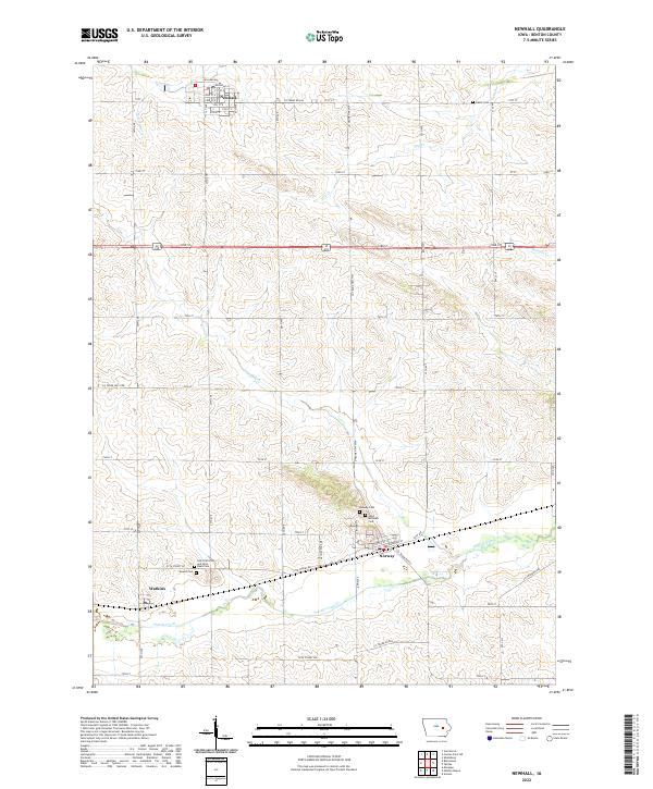
The town of Newhall serves as a primary anchor in the north, defined by a grid including 1st St E and William Way near the railroad tracks. Further south, the settlement of Norway sits along the southern rail line, accompanied by religious and historical landmarks such as Norway Cem and Saint Michaels Cem. The landscape is largely structured by the Public Land Survey System, with the boundaries of t83n r10w and t82n r9w framing a territory carved by small waterways. Prairie Creek flows through the southern half of the quadrangle, passing near the small community of Watkins. Researchers can trace local genealogy through several rural burial grounds, including the Saint Patricks and Saint Pauls Cem and the Mound Cem located west of Norway. This rural Iowa landscape maintains a traditional agricultural grid, with named county roads like Co Trunk Rd E44 and Co Trunk Rd E66 connecting the scattered farmsteads and small towns.
Find a feature on this map
41 named features on this map. Tap any name to fly to it.
Don’t see what you’re looking for? This feature index may not catch every label — zoom into the map to look around manually.
Map Details
Editions of this 2022 Newhall Map
This is the sole edition of this map. No revisions or reprints were ever made.