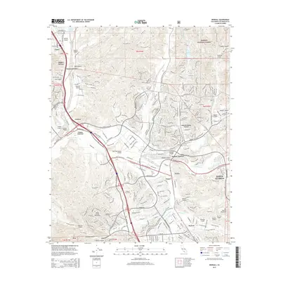
2015 Map of Newhall
USGS Topo · Published 2015About this map
The Santa Clarita Valley and its surrounding canyonlands appear in high detail during a period of significant suburban expansion north of Los Angeles. The confluence of the Santa Clara River and the S Fork Santa Clara River forms the geographic anchor for a cluster of communities including Saugus, Newhall, and the master-planned developments of Valencia. The map traces the vital water infrastructure that sustains the region, most notably the Los Angeles Aqueduct and the Dry Canyon Reservoir, alongside the academic grounds of the California Institute of the Arts and College of the Canyons. To the north and east, the transition from urban density to the open wilderness of the Angeles National Forest is immediate, defined by a complex network of ridges and canyons such as San Francisquito Canyon and Bouquet Canyon. This survey documents how 21st-century infrastructure weaves through the historical terrain of the Santa Susana Mountains.
Find a feature on this map
84 named features on this map. Tap any name to fly to it.
Don’t see what you’re looking for? This feature index may not catch every label — zoom into the map to look around manually.
Map Details
Editions of this 2015 Newhall Map
This is the sole edition of this map. No revisions or reprints were ever made.
Other maps of this area

1900 · Fernando
USGS Topo · 1:62,500

1901 · Southern California Sheet No. 1
USGS Topo · 1:250,000

1903 · Tejon
USGS Topo · 1:125,000

1903 · Camulos
USGS Topo · 1:125,000

1903 · Santa Susana
USGS Topo · 1:62,500

1904 · Southern California Sheet No. 1
USGS Topo · 1:250,000

1915 · Elizabeth Lake
USGS Topo · 1:125,000

1917 · Elizabeth Lake
USGS Topo · 1:125,000

1925 · Sylmar
USGS Topo · 1:24,000

1928 · Sylmar
USGS Topo · 1:24,000
Featured Places
- Santa Clarita, CA
- Ninetynine Oaks, CA
- Sulphur Springs, CA
- Pardee, Santa Clarita
- Bouquet Junction, Santa Clarita