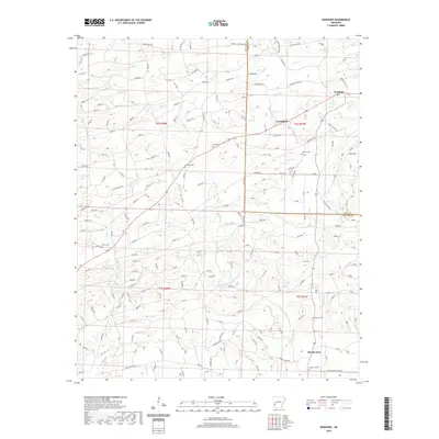
2020 Map of Newhope
USGS Topo · Published 2020About this map
Newhope anchors the northeastern corner of this Pike and Howard County borderlands survey, where the terrain is defined by a dense network of creek drainages and timbered ridges. Small, established settlements like Grandfield and Muddy Fork are situated among the winding routes of the Muddy Fork river and its tributaries, including Fallen Cr and Sugar Cr. The map reveals a deeply rooted rural community, marked by numerous burial grounds such as Bissell Cem, Antioch Cem, and Liberty Cem, which are often located near local roads like Bissell Rd and Grandfield Rd. Rising to the east, Pine Mtn provides a distinct topographic landmark above the lowlands. The intricate web of private forest roads and local routes like House Rd and Simmons Rd suggests a landscape shaped by both small-scale agriculture and the modern timber industry.
Find a feature on this map
154 named features on this map. Tap any name to fly to it.
Don’t see what you’re looking for? This feature index may not catch every label — zoom into the map to look around manually.
Map Details
Editions of this 2020 Newhope Map
This is the sole edition of this map. No revisions or reprints were ever made.
Other maps of this area

1906 · Caddo Gap
USGS Topo · 1:125,000

1913 · De Queen
USGS Topo · 1:125,000

1936 · Athens
USGS Topo · 1:48,000

1942 · Athens
USGS Topo · 1:62,500

1950 · Mcalester
USGS Topo · 1:250,000

1955 · Little Rock
USGS Topo · 1:250,000

1956 · Little Rock
USGS Topo · 1:250,000

1959 · Umpire
USGS Topo · 1:62,500

1960 · Little Rock
USGS Topo · 1:250,000

1962 · McAlester
USGS Topo · 1:250,000