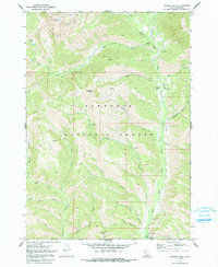
1970 Map of Newman Peak
USGS Topo · Published 1991About this map
The high alpine terrain of the Sawtooth National Forest dominates this 1970 survey, centered on the prominent Newman Peak and Two Point Mtn. The landscape is defined by the headwaters and tributaries of the South Fork Boise River, which flows through the eastern portion of the quadrangle. This area was clearly a focal point for early mining activity, as evidenced by several named claims including the Tip Top Mine, El Oro Mine, and the uniquely named Axolotl Mine near Emma Creek.
Find a feature on this map
35 named features on this map. Tap any name to fly to it.
Don’t see what you’re looking for? This feature index may not catch every label — zoom into the map to look around manually.
Map Details
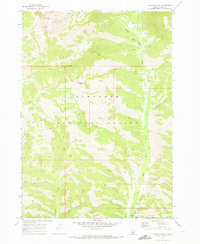
Editions of this 1970 Newman Peak Map
2 editions found
Other maps of this area

1894 · Rocky Bar
USGS Topo · 1:125,000

1900 · Sawtooth
USGS Topo · 1:125,000

1955 · Hailey
USGS Topo · 1:250,000

1959 · Hailey
USGS Topo · 1:250,000

1962 · Hailey
USGS Topo · 1:250,000

1964 · Frenchman Creek
USGS Topo · 1:24,000

1964 · Ross Peak
USGS Topo · 1:24,000
1964 · Jumbo Mtn
USGS Topo · 1:24,000

1964 · Marshall Peak
USGS Topo · 1:24,000

1970 · Sydney Butte
USGS Topo · 1:24,000