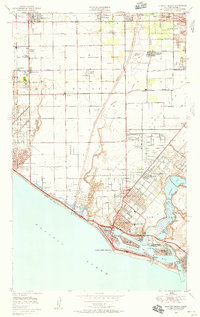
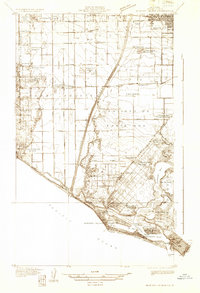
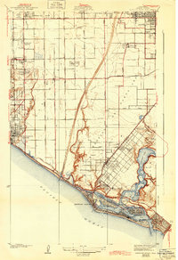
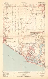
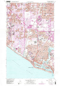
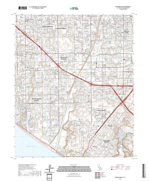
1949 Map of Newport Beach
USGS Topo · Published 1958About this map
The Santa Ana River bisects this late 1940s landscape, serving as a boundary between the expanding coastal communities of Huntington Beach and Costa Mesa. This era depicts the region just before the post-war housing boom fully transformed the landscape, showing a unique balance of industrial Oil Wells and nascent suburban developments. Inland, the influence of agriculture and rail is visible through the Pacific Electric line and small settlements like Wintersburg and Talbert. Along the coast, the intricate geography of Newport Bay is clearly defined, featuring Lido Isle, Balboa Island, and the developing harbor. Notably, the map captures early infrastructure such as the Huntington Beach Airport and the campus of Orange Coast College, alongside specialized facilities like the Federal Communications Commission station and the Naval Reservation, reflecting the region's mid-century strategic and educational growth.
Find a feature on this map
83 named features on this map. Tap any name to fly to it.
Don’t see what you’re looking for? This feature index may not catch every label — zoom into the map to look around manually.
Map Details
Editions of this 1949 Newport Beach Map
This is the sole edition of this map. No revisions or reprints were ever made.
Historical Maps of Santa Ana Through Time
9 maps found
1932 Newport Beach
Orange County, CA
1935 Newport Beach
Orange County, CA
1949 Newport Beach
Orange County, CA
1951 Newport Beach
Orange County, CA
1965 Newport Beach
Orange County, CA
2012 Newport Beach
Orange County, CA
2015 Newport Beach
Orange County, CA
2018 Newport Beach
Orange County, CA
2022 Newport Beach
Orange County, CA