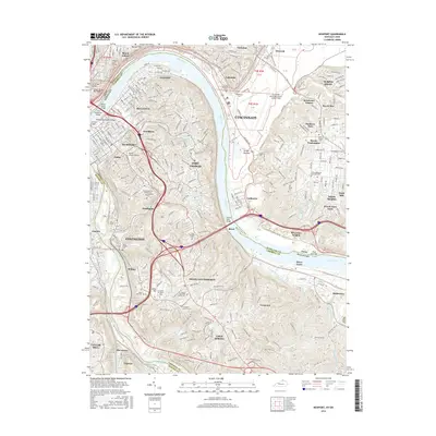
2016 Map of Newport
USGS Topo · Published 2016About this map
The Ohio River carves a deep arc between Ohio and Kentucky, defining the urban landscape of Cincinnati and its southern neighbors. This mapping captures the dense riverfront development of Newport and Covington, where numerous crossings such as the Newport Southbank Bridge and Daniel Beard Bridge link the two states. Inland, the terrain rises toward Fort Thomas and Highland Heights, where the Northern Kentucky University campus and large-scale infrastructure like the Covington Reservoirs occupy the higher ground. A high density of memorial sites, including the Evergreen Cem Soldiers Lot and Saint Stephens Cem, provides significant detail for local history researchers. To the east, the sprawling grounds of the Cincinnati Municipal Airport-Lunken Field sit within the flatlands of Turkey Bottom, illustrating the contrast between the industrial river valley and the residential suburbs of Turpin Hills and Mount Washington.
Find a feature on this map
76 named features on this map. Tap any name to fly to it.
Don’t see what you’re looking for? This feature index may not catch every label — zoom into the map to look around manually.
Map Details
Editions of this 2016 Newport Map
This is the sole edition of this map. No revisions or reprints were ever made.
Other maps of this area

1898 · East Cincinnati
USGS Topo · 1:62,500

1914 · East Cincinnati
USGS Topo · 1:62,500

1914 · West Cincinnati
USGS Topo · 1:62,500

1929 · Alexandria
USGS Topo · 1:48,000

1936 · Alexandria
USGS Topo · 1:62,500

1950 · Independence
USGS Topo · 1:24,000

1950 · Covington
USGS Topo · 1:24,000

1952 · Newport
USGS Topo · 1:24,000

1953 · Withamsville
USGS Topo · 1:24,000

1953 · New Richmond
USGS Topo · 1:24,000