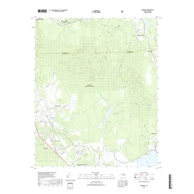
2019 Map of Newport
USGS Topo · Published 2019About this map
MCAS Cherry Point dominates the northern reaches of this coastal landscape, situated just east of Havelock at the edge of the Croatan National Forest. The geography is defined by the winding Newport River and its myriad tributaries, including Snows Swamp Br and Smiths Swamp, which feed into the tidal waters of The Narrows. This environment supported timber and early industry, evidenced by features like Mortons Mill Pond and Mill Pond.
Find a feature on this map
66 named features on this map. Tap any name to fly to it.
Don’t see what you’re looking for? This feature index may not catch every label — zoom into the map to look around manually.
Map Details
Editions of this 2019 Newport Map
This is the sole edition of this map. No revisions or reprints were ever made.
Other maps of this area

1949 · Havelock
USGS Topo · 1:24,000

1949 · Beaufort
USGS Topo · 1:24,000

1949 · Merrimon
USGS Topo · 1:24,000

1949 · Newport
USGS Topo · 1:24,000

1949 · Salter Path
USGS Topo · 1:24,000

1949 · Mansfield
USGS Topo · 1:24,000

1949 · Cherry Point
USGS Topo · 1:24,000

1949 · Core Creek
USGS Topo · 1:24,000

1949 · Masontown
USGS Topo · 1:24,000

1951 · Salter Path
USGS Topo · 1:24,000