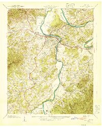
1940 Map of Newport
USGS Topo · Published 1940About this map
The confluence of the Pigeon River and the French Broad River anchors this 1940 study of Cocke County, Tennessee. The town of Newport is shown in detail, surrounded by industrial and community landmarks including Tannery Island and the Southern Railway line. This era captures the area's rural social infrastructure through its many localized schools and churches, such as the Rosenwald Sch and Big Pigeon Ch, reflecting a landscape organized around small agrarian settlements. To the south, the terrain rises sharply into the English Mtn and the Cherokee National Forest, while the lowland areas are dotted with family-named cemeteries like Inman Cem and Hannan Cem. The presence of the County Farm and multiple named islands like Boyer Island illustrate the river-driven economy and civic organization of the pre-war period.
Find a feature on this map
77 named features on this map. Tap any name to fly to it.
Don’t see what you’re looking for? This feature index may not catch every label — zoom into the map to look around manually.
Map Details
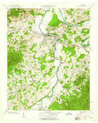
Editions of this 1940 Newport Map
2 editions found
Other maps of this area

1883 · Morristown
USGS Topo · 1:125,000

1893 · Mt Guyot
USGS Topo · 1:125,000

1893 · Morristown
USGS Topo · 1:125,000

1895 · Morristown
USGS Topo · 1:125,000

1912 · Mt Guyot
USGS Topo · 1:125,000

1935 · Newport
USGS Topo · 1:48,000

1935 · White Pine
USGS Topo · 1:24,000

1935 · Hartford
USGS Topo · 1:24,000

1935 · English Mountain
USGS Topo · 1:48,000

1935 · Parrottsville
USGS Topo · 1:24,000