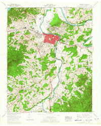
1961 Map of Newport
USGS Topo · Published 1965About this map
The Pigeon River and French Broad River converge near Newport, shaping the early industrial and transit patterns of Cocke County. In the early 1960s, the landscape shows a mix of established neighborhoods like Northport, Eastport, and West End alongside emerging infrastructure like Interstate 40. The riverbanks are dotted with significant geographical landmarks, including Tannery Island and Susong Island, while the Southern railroad line parallels the water, reinforcing the area's history as a regional hub.
Find a feature on this map
79 named features on this map. Tap any name to fly to it.
Don’t see what you’re looking for? This feature index may not catch every label — zoom into the map to look around manually.
Map Details
Editions of this 1961 Newport Map
3 editions found
Other maps of this area

1883 · Morristown
USGS Topo · 1:125,000

1893 · Mt Guyot
USGS Topo · 1:125,000

1893 · Morristown
USGS Topo · 1:125,000

1895 · Morristown
USGS Topo · 1:125,000

1912 · Mt Guyot
USGS Topo · 1:125,000

1935 · Newport
USGS Topo · 1:48,000

1935 · White Pine
USGS Topo · 1:24,000

1935 · Hartford
USGS Topo · 1:24,000

1935 · English Mountain
USGS Topo · 1:48,000

1935 · Parrottsville
USGS Topo · 1:24,000