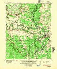
1935 Map of Newport
USGS Topo · Published 1954About this map
The confluence of the White River and Black River dominates this mid-1930s landscape, where river commerce and railroad expansion shaped Jackson County's development. Newport serves as the primary hub, showing an intricate network of flood gates and levees like the Bateman Levee designed to manage the volatile delta terrain. The map captures a transition from the elevated Ozark Escarpment in the northwest down to the fertile bottomlands of Pleasant Island and Padgett Island.
Find a feature on this map
178 named features on this map. Tap any name to fly to it.
Don’t see what you’re looking for? This feature index may not catch every label — zoom into the map to look around manually.
Map Details
Editions of this 1935 Newport Map
2 editions found
Other maps of this area

1890 · Batesville
USGS Topo · 1:125,000

1891 · Batesville
USGS Topo · 1:125,000

1932 · Strawberry
USGS Topo · 1:62,500

1935 · Alicia
USGS Topo · 1:62,500

1935 · Strawberry
USGS Topo · 1:62,500

1935 · Newport
USGS Topo · 1:62,500

1935 · Augusta
USGS Topo · 1:62,500

1935 · Tuckerman
USGS Topo · 1:62,500

1935 · Bald Knob
USGS Topo · 1:62,500

1940 · Tilton
USGS Topo · 1:62,500