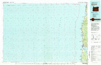
1981 Map of Newport
USGS Topo · Published 1981About this map
The central Oregon coast at the start of the 1980s is defined by its deep estuaries and rugged shorelines within Lincoln County. This survey highlights the coastal development around Newport, a major hub at the mouth of Yaquina Bay, where the Yaquina River meets the Pacific. The map traces the growth of coastal towns like Lincoln City and Depoe Bay, as well as smaller communities such as Gleneden Beach and Otter Rock. Land use patterns show a distinct mix of recreation and resource management, with vast stretches of the Siuslaw National Forest bordering a series of state parks, including Rocky Creek State Park and Beverly Beach State Park. The interior is marked by significant terrain features like Iron Mtn, while the coastline is anchored by functional landmarks such as the Lighthouse at Yaquina Head and the Newport Airport to the south.
Find a feature on this map
57 named features on this map. Tap any name to fly to it.
Don’t see what you’re looking for? This feature index may not catch every label — zoom into the map to look around manually.
Map Details
Editions of this 1981 Newport Map
This is the sole edition of this map. No revisions or reprints were ever made.
Other maps of this area

1922 · Waldport
USGS Topo · 1:62,500

1941 · Nestucca Bay
USGS Topo · 1:62,500

1941 · Cape Foulweather
USGS Topo · 1:62,500

1942 · Euchre Mtn
USGS Topo · 1:62,500

1942 · Waldport
USGS Topo · 1:62,500

1942 · Nestucca Bay
USGS Topo · 1:62,500

1942 · Yaquina
USGS Topo · 1:62,500

1942 · Tidewater
USGS Topo · 1:62,500

1942 · Toledo
USGS Topo · 1:62,500

1943 · Euchre Mtn
USGS Topo · 1:62,500