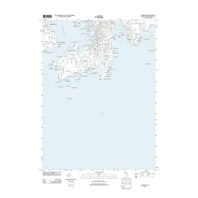
2012 Map of Newport
USGS Topo · Published 2012About this map
Fort Adams and the maritime infrastructure of Newport Harbor anchor this detailed study of the Rhode Island coast in the early 21st century. The map highlights the city's complex historical layerings, from colonial-era burial sites like the Common Ground Cem and The Jewish Cem to the sprawling grounds of Salve Regina University along the eastern shore. The coastal landscape is defined by its working waterfront, marked by numerous landings such as Bowens Wharf, Waites Wharf, and Ann Street Pier, which supported centuries of naval and commercial activity. Across the water, the defenses of Fort Wetherill and the historic Hammersmith Farm on Newport Neck illustrate the strategic and social significance of this peninsula. Navigation remains central to the area's identity, evidenced by the Newport-Jamestown Ferry Crossing and the prominent Newport Harbor Lighthouse.
Find a feature on this map
199 named features on this map. Tap any name to fly to it.
Don’t see what you’re looking for? This feature index may not catch every label — zoom into the map to look around manually.
Map Details
Editions of this 2012 Newport Map
This is the sole edition of this map. No revisions or reprints were ever made.
Other maps of this area

1885 · Sakonnet
USGS Topo · 1:62,500

1888 · Fall River
USGS Topo · 1:62,500

1888 · Sakonnet
USGS Topo · 1:62,500

1889 · Newport
USGS Topo · 1:62,500

1890 · Narragansett Bay
USGS Topo · 1:62,500

1892 · Narragansett Bay
USGS Topo · 1:62,500

1893 · Sakonnet
USGS Topo · 1:62,500

1893 · Fall River
USGS Topo · 1:62,500

1894 · Newport
USGS Topo · 1:62,500

1904 · Newport
USGS Topo · 1:62,500