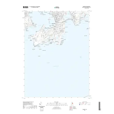
2021 Map of Newport
USGS Topo · Published 2021About this map
Newport's historic core and harbor dominate this coastal survey, where a dense concentration of civic and religious history is visible through numerous burial grounds and landmarks. Genealogists can trace family lineages through the Island Cem, Common Burial Ground Cem, and several smaller plots like the Jewish Cem and Arnold Burying Ground. The maritime character of Newport Neck is defined by its complex shoreline, from the defensive site of Ft Wetherill on the west to the university grounds at Salve Regina University on the eastern cliffs. The landscape is a mix of established urban blocks, including the Murray Judicial Complex, and the rugged, rocky points of the south shore such as Brenton Point and Gooseberry Island. Across the East Passage, the map captures the eastern edge of Jamestown and its own local landmarks like The Dumplings.
Find a feature on this map
173 named features on this map. Tap any name to fly to it.
Don’t see what you’re looking for? This feature index may not catch every label — zoom into the map to look around manually.
Map Details
Editions of this 2021 Newport Map
This is the sole edition of this map. No revisions or reprints were ever made.
Other maps of this area

1885 · Sakonnet
USGS Topo · 1:62,500

1888 · Fall River
USGS Topo · 1:62,500

1888 · Sakonnet
USGS Topo · 1:62,500

1889 · Newport
USGS Topo · 1:62,500

1890 · Narragansett Bay
USGS Topo · 1:62,500

1892 · Narragansett Bay
USGS Topo · 1:62,500

1893 · Sakonnet
USGS Topo · 1:62,500

1893 · Fall River
USGS Topo · 1:62,500

1894 · Newport
USGS Topo · 1:62,500

1904 · Newport
USGS Topo · 1:62,500