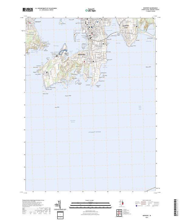
2024 Map of Newport
USGS Topo · Published 2024About this map
Newport and its immediate surroundings on Rhode Island Sound are meticulously documented, revealing a coastal landscape defined by maritime heritage and a high density of ancestral burial sites. This survey highlights the complex shoreline from Southwest Point on Conanicut Island to the eastern reaches of Sachuest Point National Wildlife Refuge. The map serves as a vital record for genealogists, featuring numerous colonial-era and family plots such as the John Clarke Burial Ground, the Governor Benedict Arnold Graveyard, and the Colonial Jewish Cem. Institutional landmarks like Salve Regina University and the Murray Judicial Complex anchor the modern city, while the southern peninsula's winding roads like Ocean Ave trace the rocky perimeter of Newport Neck, passing significant natural features like Lily Pond and Gooseberry Island.
Find a feature on this map
113 named features on this map. Tap any name to fly to it.
Don’t see what you’re looking for? This feature index may not catch every label — zoom into the map to look around manually.
Map Details
Editions of this 2024 Newport Map
This is the sole edition of this map. No revisions or reprints were ever made.
Other maps of this area

1885 · Sakonnet
USGS Topo · 1:62,500

1888 · Fall River
USGS Topo · 1:62,500

1888 · Sakonnet
USGS Topo · 1:62,500

1889 · Newport
USGS Topo · 1:62,500

1890 · Narragansett Bay
USGS Topo · 1:62,500

1892 · Narragansett Bay
USGS Topo · 1:62,500

1893 · Sakonnet
USGS Topo · 1:62,500

1893 · Fall River
USGS Topo · 1:62,500

1894 · Newport
USGS Topo · 1:62,500

1904 · Newport
USGS Topo · 1:62,500