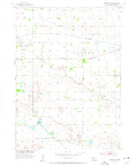
1954 Map of Newport SW
USGS Topo · Published 1956About this map
The North Fork Elkhorn River and South Fork Elkhorn River dominate this mid-century survey of Rock County, Nebraska. The landscape is defined by the east-west passage of the Chicago and North Western railroad, which cuts through the northern townships of Center and Bassett. This area reflects a sparse, rural settlement pattern typical of the Sandhills region, where development is clustered around water sources and transportation lines. Educational infrastructure is prominent throughout the quadrants of Thurman and Lay, with several numbered institutions including School No 27, School No 35, and School No 24 serving the ranching community. The map also features the distinctive Glendale Sch near the eastern boundary and Adams Lake in the south-central portion, providing specific landmarks for genealogists tracing family landholdings in this part of Nebraska.
Find a feature on this map
12 named features on this map. Tap any name to fly to it.
Don’t see what you’re looking for? This feature index may not catch every label — zoom into the map to look around manually.
Map Details
Editions of this 1954 Newport SW Map
2 editions found
Other maps of this area

1949 · Riverview
USGS Topo · 1:24,000

1949 · Carns
USGS Topo · 1:24,000

1950 · Carns
USGS Topo · 1:24,000

1950 · Riverview
USGS Topo · 1:24,000

1954 · Newport NE
USGS Topo · 1:24,000

1954 · Bassett
USGS Topo · 1:24,000

1954 · Newport
USGS Topo · 1:24,000

1954 · Newport SW
USGS Topo · 1:24,000

1955 · O'Neill
USGS Topo · 1:250,000

1959 · O'Neill
USGS Topo · 1:250,000