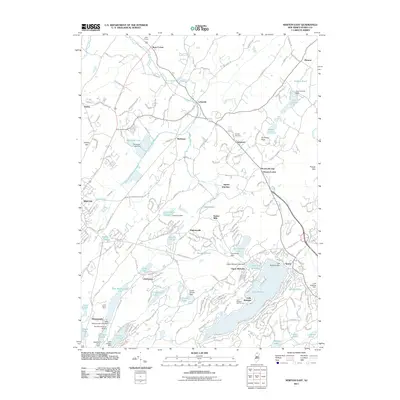
2011 Map of Newton East
USGS Topo · Published 2011About this map
Lake Mohawk serves as a major focal point for this Sussex County landscape, surrounded by several smaller water bodies including Upper Lake Mohawk, Lake Iliff, and Lake Grinnell. The area exhibits a mix of residential development and industrial land use, notably the large Limecrest Quarry and the Aeroflex-Andover Airport near Wawayanda. Settlement patterns are defined by historic junctions and crossroads such as Sparta Junction, Ross Corner, and Woodruffs Gap.
Find a feature on this map
221 named features on this map. Tap any name to fly to it.
Don’t see what you’re looking for? This feature index may not catch every label — zoom into the map to look around manually.
Map Details
Editions of this 2011 Newton East Map
This is the sole edition of this map. No revisions or reprints were ever made.
Other maps of this area

1888 · Franklin
USGS Topo · 1:62,500

1888 · Hackettstown
USGS Topo · 1:62,500

1888 · Lake Hopatcong
USGS Topo · 1:62,500

1891 · Wallpack
USGS Topo · 1:62,500

1893 · Wallpack
USGS Topo · 1:62,500

1894 · Hackettstown
USGS Topo · 1:62,500

1894 · Lake Hopatcong
USGS Topo · 1:62,500

1894 · Franklin
USGS Topo · 1:62,500

1897 · Franklin
USGS Topo · 1:62,500

1898 · Lake Hopatcong
USGS Topo · 1:62,500