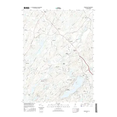
2016 Map of Newton East
USGS Topo · Published 2016About this map
Lake Mohawk and the Sparta Mountains dominate the southeastern landscape of this Sussex County study, where suburban development meets the natural geography of the Highlands. The waters of Paulins Kill flow through the northern reaches near Lafayette and Ross Corner, anchoring a region defined by its numerous glacial lakes and ponds. The infrastructure of the Morris & Essex RR traces a path through Sparta Junction and Warbasse, marking the historical transit corridors that linked these communities. To the west, the outskirts of Newton show the transition from the county seat's dense street grid to the surrounding rural hillsides. Local history is preserved in smaller settlements like Pinkneyville and Sussex Mills, while the Vaughn Cem near Ackerson provides a specific point of interest for genealogists tracing family roots in the area.
Find a feature on this map
202 named features on this map. Tap any name to fly to it.
Don’t see what you’re looking for? This feature index may not catch every label — zoom into the map to look around manually.
Map Details
Editions of this 2016 Newton East Map
This is the sole edition of this map. No revisions or reprints were ever made.
Other maps of this area

1888 · Franklin
USGS Topo · 1:62,500

1888 · Hackettstown
USGS Topo · 1:62,500

1888 · Lake Hopatcong
USGS Topo · 1:62,500

1891 · Wallpack
USGS Topo · 1:62,500

1893 · Wallpack
USGS Topo · 1:62,500

1894 · Hackettstown
USGS Topo · 1:62,500

1894 · Lake Hopatcong
USGS Topo · 1:62,500

1894 · Franklin
USGS Topo · 1:62,500

1897 · Franklin
USGS Topo · 1:62,500

1898 · Lake Hopatcong
USGS Topo · 1:62,500