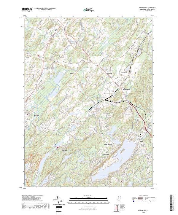
2023 Map of Newton East
USGS Topo · Published 2023About this map
Newton serves as a primary hub in this Sussex County landscape, where the drainage of the Paulins Kill and Wallkill River shapes the local geography. The map reveals a transition from the established borough streets of Newton to the cluster of lakeside communities and rural hamlets like Lafayette, Pinkneyville, and Warbasse. The development patterns around Lake Mohawk and Lake Lenape contrast with the open expanses of Germany Flats and the elevations of the Pimple Hills.
Find a feature on this map
223 named features on this map. Tap any name to fly to it.
Don’t see what you’re looking for? This feature index may not catch every label — zoom into the map to look around manually.
Map Details
Editions of this 2023 Newton East Map
This is the sole edition of this map. No revisions or reprints were ever made.
Other maps of this area

1888 · Franklin
USGS Topo · 1:62,500

1888 · Hackettstown
USGS Topo · 1:62,500

1888 · Lake Hopatcong
USGS Topo · 1:62,500

1891 · Wallpack
USGS Topo · 1:62,500

1893 · Wallpack
USGS Topo · 1:62,500

1894 · Hackettstown
USGS Topo · 1:62,500

1894 · Lake Hopatcong
USGS Topo · 1:62,500

1894 · Franklin
USGS Topo · 1:62,500

1897 · Franklin
USGS Topo · 1:62,500

1898 · Lake Hopatcong
USGS Topo · 1:62,500